A powerful storm system is set to impact over 100 million Americans starting Friday, bringing a mix of extreme weather across the Great Plains and beyond. The multi-day event is expected to unleash blizzards, tornadoes, flooding, and even wildfires as it moves eastward.
While the storm’s intensity is striking, meteorologists note that such weather patterns are common in spring due to the collision of warming temperatures with lingering winter air.
“This is the time of year when storms like this can have widespread effects,” said Penn State University meteorologist Benjamin Reppert.
Storm Threats Across Multiple Regions
The National Weather Service predicts strong winds from the Canadian border to the Rio Grande on Friday, with gusts reaching up to 80 mph (130 kph), heightening fire risks in Texas, New Mexico, and Oklahoma. Meanwhile, winter weather is expected in parts of the Rockies and Northern Plains, with potential blizzards in the Dakotas and Minnesota.
Severe thunderstorms capable of producing tornadoes and large hail are forecast from the Gulf Coast to Wisconsin. By Saturday, the storm system will move toward Louisiana, Mississippi, Alabama, Tennessee, and Florida, raising concerns about flooding from the Central Gulf Coast to the Ohio Valley.
Storms cause blizzards, threaten more tornadoes in US
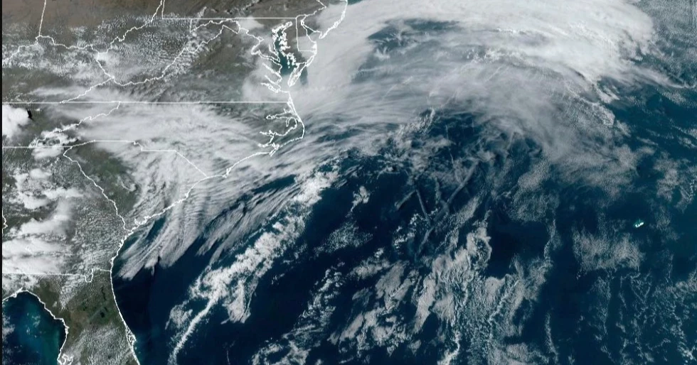
On Sunday, the East Coast is expected to experience strong winds and localized flash flooding, with heavy rainfall predicted along the Interstate 95 corridor down to Jacksonville, Florida.
What’s Fueling the Storm?
Meteorologists attribute the storm's strength to a combination of atmospheric conditions. Reppert noted that upper-level temperatures in the central and eastern U.S. are near record highs, while the western states are experiencing unusually cold air masses. This contrast is a key factor in the storm’s intensity.
Colorado State University climatologist Russ Schumacher suggested the system could develop into a bomb cyclone by Friday evening, a term used when atmospheric pressure rapidly drops within 24 hours, leading to stronger winds and heavier rainfall.
The storm is also being shaped by the jet stream, which is dipping southward, helping to lift warm, moisture-laden air into the atmosphere. Additionally, warm waters in the Gulf of Mexico—ranging 2 to 4 degrees Fahrenheit (1.1 to 2.2 degrees Celsius) above historical averages—are contributing to the storm’s development.
Tornadoes kill 5, injure 83 in China's eastern Shandong province
Ryan Torn, an atmospheric sciences professor at the University at Albany, described the conditions as a “Goldilocks situation,” where multiple atmospheric factors align to intensify the storm.
Source: With input from agency