
The Mars Express mission of the European Space Agency has spotlighted Shalbatana Vallis, a vast Martian valley showing strong evidence of ancient water activity, volcanic processes and geological transformation.
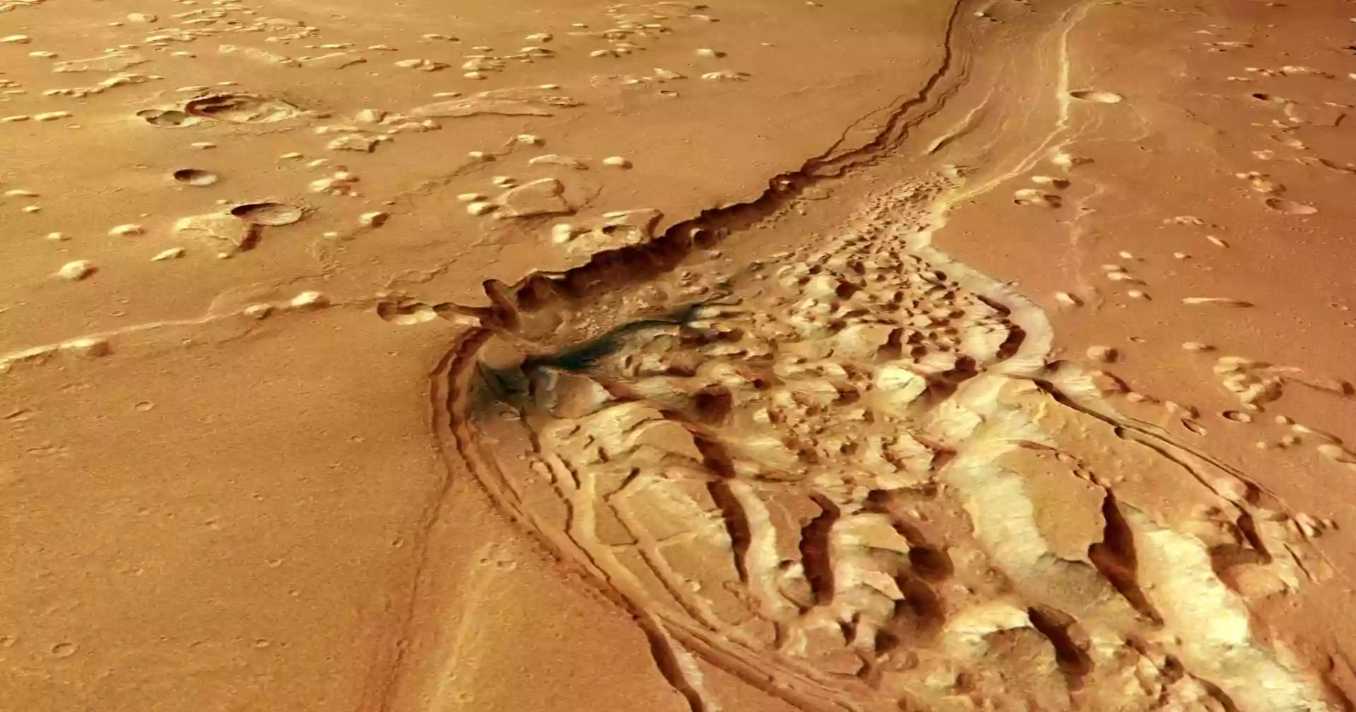
Located near the Martian equator, Shalbatana Vallis stretches about 1,300 kilometres—roughly the length of Italy. A new image captured by the spacecraft’s High Resolution Stereo Camera (HRSC) focuses on the northern section of the valley as it winds across the planet’s surface.
In October 2025, Mars Express also released a video tracing the valley’s path from its source in the highlands of Xanthe Terra to its endpoint in the smoother terrain of Chryse Planitia.
Ancient floods shaped the valley
Scientists believe the valley formed around 3.5 billion years ago when massive volumes of underground water burst onto the surface, carving deep channels as they flowed downhill.
The main valley, about 10 kilometres wide and up to 500 metres deep, enters from the lower left of the image and exits toward the north. Researchers say it was likely deeper in the past, but over time sediments gradually filled parts of the channel.
A distinct dark patch in the rougher section of the valley is believed to be volcanic ash that was later redistributed by Martian winds.
Signs of water, lava and a possible ocean
Shalbatana Vallis is one of many outflow channels in the region, marking the transition between Mars’ heavily cratered southern highlands and the smoother northern lowlands.
Nearby lies Chryse Planitia, one of the lowest regions on the planet, where many major outflow channels end. Scientists suggest the area may once have hosted a large ocean during a warmer and wetter period in Mars’ history.
Chaotic terrain and impact features
The surrounding region contains “chaotic terrain,” characterized by broken rock blocks, ridges and irregular landforms. Scientists believe this formed when underground ice melted, causing the ground above to collapse.
Similar terrain has been observed in other areas, including Pyrrhae Regio, Iani Chaos, Ariadnes Colles, Aram Chaos and Hydraotes Chaos.
Numerous impact craters are also visible across the region. Some remain sharply defined, while others have been partially buried or eroded over time. Several are surrounded by ejecta blankets—debris thrown outward during impacts.
The smoother appearance of parts of the terrain suggests past lava flows. As the lava cooled and contracted, it formed uneven features known as wrinkle ridges. Isolated hills, or mesas, are also visible as remnants of older elevated surfaces.
Two decades of exploration
The HRSC camera is one of eight instruments aboard Mars Express, which has been studying Mars since its launch in 2003. Over more than two decades, the mission has produced detailed colour and three-dimensional maps of the planet, significantly advancing understanding of its geological history.
The camera was developed and is operated by the German Aerospace Center (DLR), with data processed in Berlin and further analysed by researchers at Freie Universität Berlin.
Source: Science Daily