
Land management

Land management across the country will soon be digital: Adviser
The Land Management system across the country will soon be fully digital, Land Adviser Ali Imam Majumder has said.
Speaking to reporters after the first session on the second day of the three-day District Commissioners (DCs) conference at the Osmani Memorial Auditorium on Monday, Majumder said that the transition from the traditional system to a digital one might be difficult at first, but over time, people’s difficulties will be alleviated.
Senior Secretary of the Land Ministry, ASM Saleh Ahmed, was also present at the briefing.
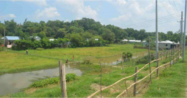
Workshop discusses challenges in digital land survey operations
Majumder further said that the chief adviser is committed to making land management across the country digital. Currently, survey work is being conducted with drones, and the government is utilising modern technologies.
He added that trained personnel and companies are being brought in to assist, and training programmes are underway. "I hope that day is not far when land management across the country will be fully digital," he said.
In response to a question about whether the pending applications for e-namzaari will be processed before March 10, Majumder informed that it is an ongoing process, with applications being continuously received. He expressed optimism that the system would be functional before March 10.
Tk 338-cr project planned for digital land zoning
Senior Secretary Saleh Ahmed said that when the digital process began, there were about 4.5 lakh pending applications nationwide, but that number has since decreased and will continue to drop.
This will also reduce the harassment faced by people.
"Our goal is to complete it by March 10, and I hope people will be able to use the system smoothly before then. There is no issue with the ‘porcha’ now. Our suffering has reduced by 80 percent," he added.
1 year ago
Bangladesh to automate land management and services, says official document
The government plans to bring all land-related services under automation through 18 integrated software in a bid to the make age-old system more dynamic and transparent and user-friendly.
The planned land automation management will create an interoperable land database providing fast and hassle-free online services such as Namjari, giving land development tax, collecting Porcha across the country, according to an official document obtained by UNB.
To this end, three projects have been taken so far.
The projects are- Strengthening governance management project (Component- B: Digital Land Management System), Digital land record, Survey and Maintenance project, and National Land Zoning project.
Read: Seminar on land management held at IU
Besides, to protect the arable land and to ensure food security there will be Mouza and plot based national digital land zoning.
As per the document, after completion of digital zoning depending of the usage of land it would be possible to take decision on protecting agricultural land of the country and its maximum utilisation.
The government has also taken move to bring all cases of the revenue courts under one integrated networking system to accelerate case disposal and mitigate public sufferings.
The project titled "Land Management Automation" that got Executive Committee of the National Economic Council (ECNEC) approval is scheduled to end in June 2025, and its cost has been estimated at Tk 1,197.0318 crore.
Read Govt to spend Tk 4,167cr on 10 projects, Ecnec gives nod
According to the officials people would get land mutation, lease, and tax payment facilities online without hassle after completion of the project apart from bringing transparency in revenue collection.
About 5,247 land offices will be connected online to provide services to people.
Once the project is properly implemented, the number of land-related disputes and other incidents will be reduced significantly.
It would also reduce the influence of middlemen in land related cases.
The ministry of land will implement the mouza- and plot-based national digital land-zoning project. The project will cover some 56,348 mouzas under 4,562 unions of 493 upazilas in all the 64 districts of the country.
Read Ecnec rejects Tk 17,290-cr primary school meal project
Satellite images will be used for this digital land-zoning, while mouza maps will also be digitalized.
According to the project proposal, it will ensure collection, scanning, digitization, database creation, editing plot checking, geo-referencing mouza map, matching of mouza map, and field checking of some 1,38,412 sheets of maps.
In most countries, people get all land-related services, including that for land records and registrations, from a single office.
But in Bangladesh, three offices provide the services that cause sufferings to people and kill huge time. The present method of land recording in land management and registration offices follow the age-old system of hand-written documents.
Read: Russia to help Bangladesh in land management
Bangladesh's land has been divided in terms of authorisation, which continues to pose a problem.
4 years ago

