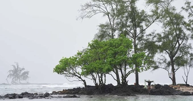
Residents of Hawaii’s Big Island are preparing for another potentially devastating storm as Hurricane Nolo moves south of the islands. Forecasters expect the system to produce dangerous flash flooding, powerful waves and strong winds through the weekend.
Nolo was forecast to intensify into a major hurricane Saturday. Its maximum sustained winds reached 105 mph (165 kph) on Friday, while the storm’s center was approximately 185 miles (300 kilometers) south of the southernmost point of Hawaii.
Forecasters said some parts of the Big Island could receive as much as 15 inches (38 centimeters) of rain, with isolated totals potentially reaching 25 inches (64 centimeters). The forecast was lower than earlier estimates of up to 35 inches (89 centimeters).
Michael Brennan, director of the National Hurricane Center, urged people on the Big Island to remain indoors and in secure locations as conditions deteriorate. He warned that residents should avoid unnecessary travel because flooding, powerful winds, fallen trees and downed power lines could make roads extremely dangerous.
Heavy rain could also affect other Hawaiian islands. Maui was among the areas facing the possibility of severe rainfall, dangerous flooding and mudslides.
On Friday, crews on the Big Island worked for hours constructing berms to redirect floodwater and removing large debris before the heaviest rainfall arrived, according to Erika Kapu, Hawaii program manager for humanitarian organization CORE.
CORE and other nonprofit groups had spent the week transporting relief supplies, including portable stoves and hygiene materials, from Oahu to the Big Island. The supplies were being stored at a community relief center that has operated since Hurricane Lala struck in August.
Hawaii Mobilizes for Nolo
President Donald Trump approved an emergency declaration for Hawaii on Friday. The move allows the Federal Emergency Management Agency to coordinate federal assistance and provide financial support for emergency response efforts.
State authorities advised residents to prepare emergency supplies, while Hawaii’s governor issued an emergency proclamation and activated more than 230 National Guard personnel. Some schools were also closed.
Officials in Hawaii County encouraged residents living in areas vulnerable to flooding to consider moving to designated shelters or other safe locations.
The heaviest rainfall from Nolo was expected to affect the southeastern part of the Big Island, an area already hit by Hurricane Lala and still saturated from recent rainfall. Forecasters also warned that storm surge could reach between 1 and 3 feet (30 to 91 centimeters), potentially producing dangerous waves and coastal flooding.
Hawaiian Electric said crews that had been assisting with power restoration on Kauai following Hurricane Lowell would be redeployed to Oahu, Maui and the Big Island to prepare for Nolo.
People on the Big Island were making last-minute preparations. In Hilo, where light rain was falling Friday, residents collected sand and gravel at Francis Wong Stadium, which had been designated as a sand distribution site.
Dean Taise said water had begun flowing from the street into his driveway, prompting him to prepare several sandbags in case flooding worsened.
At Hilo International Airport, large stacks of sandbags were visible as travelers attempted to leave the island. Daniela Mendoza was trying to return to Oahu after Southwest Airlines canceled flights. Hawaiian Airlines remained the only carrier operating flights from the airport Friday afternoon.
Mendoza said she hoped to get home because her cats were waiting for her.
Hurricane Polo Strengthens Again Near Mexico
Meanwhile, Mexico was preparing for Hurricane Polo, which was moving toward the Baja California peninsula after bringing dangerous conditions to parts of the country’s southwestern Pacific coast.
The hurricane gained considerable strength overnight and into Friday morning, bringing heavy weather to sections of Mexico’s Pacific shoreline. No major flooding or widespread damage had been reported along the coast through Friday morning.
By Friday afternoon, officials were increasingly focused on the Baja California peninsula, where Polo was expected to curve back toward land and make an impact between Monday and Tuesday. Authorities began preparing shelters, while Mexico’s government announced the closure of ports in the affected region.
Polo’s estimated maximum sustained winds reached 180 mph (290 kph).
Residents in some coastal communities filled and placed sandbags around businesses and evacuated their homes Thursday. Authorities opened emergency shelters, cleared beaches and deployed about 15,000 security personnel along the coast. Schools were also closed in affected areas.
In Lázaro Cárdenas, a port city in Michoacán, seawater entered homes, leaving furniture, wooden boards and other debris scattered through the streets. Residents and officials worked to remove debris and clear thick layers of mud.
Restaurant owner Alicia Contreras said waves reaching about 15 feet (4.5 meters) had badly damaged the walls and roof of her business. She expressed concern about her financial future because the restaurant is her only source of income.
Brennan said moisture linked to Polo could move into parts of the southwestern United States by Monday. That moisture could trigger isolated flash flooding in the Four Corners region, particularly in parts of Arizona and New Mexico.
In Southern California, biologists moved eggs from two olive ridley sea turtle nests to the Aquarium of the Pacific in Long Beach. The relocation was carried out because of concerns about high tides and dangerous surf associated with Polo.
El Niño Contributes to Increased Pacific Storm Activity
The powerful storms are occurring during an El Niño weather pattern, which can cause major changes in weather conditions around the globe. While El Niño often reduces hurricane activity in the Atlantic, it can increase tropical cyclone activity in the Pacific by creating wetter conditions and reducing wind shear.
Another Pacific storm, Hurricane Odalys, remained a Category 4 hurricane Friday but was still far from land. It was located approximately 955 miles (1,537 kilometers) west-southwest of the southern tip of the Baja California peninsula.
Two other strong tropical systems were also active in the Atlantic, although neither posed an immediate threat to land.
Tropical Storm Fay re-formed in the northern Atlantic early Thursday and was located about 1,040 miles (1,674 kilometers) west-southwest of the Azores by Friday.
Meanwhile, Tropical Storm Gonzalo strengthened early Friday near the west coast of Africa as it moved toward the Cabo Verde Islands.