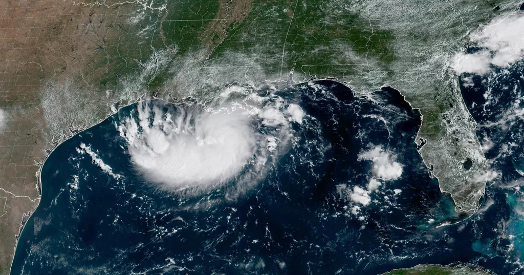
Tropical Storm Edouard formed in the Gulf of Mexico on Monday and was expected to strengthen before bringing heavy rain and possible flooding to parts of Texas and Louisiana.
The system was upgraded from a tropical depression Monday night, and forecasters at the National Hurricane Center said it was expected to make landfall in Texas on Tuesday.
Texas Gov. Greg Abbott said flooding was expected to be the storm’s main threat. Forecasters predicted 3-6 inches (7-15 centimeters) of rain across the greater Houston area, while some parts of the state’s upper coast could receive as much as 9 inches (22 centimeters).
More than 4 inches (10 centimeters) of rain could fall in an hour in some areas, potentially triggering flash floods, particularly in low-lying and urban locations, the National Hurricane Center said.
“This is our first big storm of the season, and I’ll tell you, Texas is prepared,” Orlando Alanis of the Texas Division of Emergency Management said at a news conference.
Edouard was centered Monday evening about 125 miles (202 kilometers) southeast of Cameron, Louisiana, and 155 miles (249 kilometers) southeast of Port Arthur, Texas. It had maximum sustained winds of 40 mph (65 kph).
Abbott said crews were also working to remove dry vegetation that could catch fire if struck by lightning and allow flames to spread rapidly.
Meanwhile, the remnants of Hurricane Dolly brought rain and thunderstorms to parts of Haiti, the Dominican Republic, Turks and Caicos, and the Bahamas, according to the hurricane center.
Storm Lowell heads toward Hawaii
In the Pacific Ocean, Tropical Storm Lowell was located about 690 miles (1,110 kilometers) southeast of Hilo, Hawaii, and was moving westward with maximum sustained winds of 70 mph (110 kph).
Forecasters warned that Lowell could strengthen rapidly and reach major hurricane status by Wednesday.
Elsewhere in the Pacific, Hurricane Karina intensified Monday into a powerful Category 4 storm but posed no immediate threat to land, forecasters said.
Karina rapidly strengthened after becoming a hurricane Sunday, fueled by unusually warm ocean waters far from land.
The storm was centered more than 1,100 miles (1,770 kilometers) west-southwest of the southern tip of Mexico’s Baja California peninsula and was moving westward with maximum sustained winds of 130 mph (215 kph), the National Hurricane Center said.